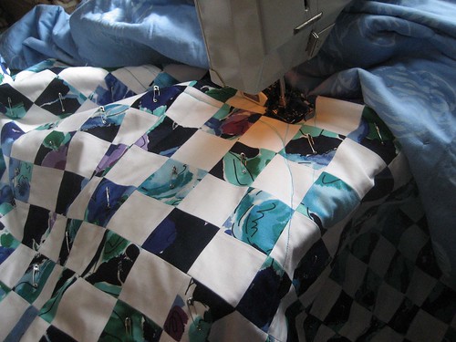
From very early on, this postage stamp quilt reminded of the
township and range plating system so much in evidence in Kansas. When I was in college, I spent one summer working for the
Kansas Geological Survey measuring gravity across the state. (If you stay in one place all day and measure the gravity, you will see 'tides'; when the measurements are plotted on a graph, there will be two high points and two low points each day -- solid earth tides, just like ocean tides, caused by the pull of the moon. The data we collected helped reveal the Kansas sub-surface.) We drove the country roads of rural Kansas and they mostly follow the grid of the one mile squares of the township and range. This may be the source of my love of the geometric and rectilinear! Anyway, I love the tidy order of these crisp postage stamp squares, but they seemed to want some.... geography.
So I am quilting a river system on them! Well, sort of. There will be a diagonal line with two 'tributary' lines coming in from either side. Then, I will just sort of echo-quilt the rest of the space.
We'll see how this works out....


4 comments:
I love that term..quilt me a river!! It's looking good.
You've got me singing the song,(I like the Aaron Neville version). I love your quilting idea. You're great at looking outside the square for your inspiration.
What a great idea! I've been thinking about quilting as secondary design too. I'll look forward to seeing the results!
Sounds good! Look forward to seeing it! :)
Post a Comment